Invitation to Kumano Kodo from or to Koyasan

My home town is at the foot of Koya-san within Kumano-Kodo World Heritage, I have visited Koyasan for many times but only by car or train. And This is for the first time to walk donw from Koyasan to my hometown around Kumano-Kodo for 20km. It takes 6 hours down from Koyasan. And It may take 8 hours to climb up from the base to Koyasan around Kumano Kodo. I decided to go to Koyasan by train with my sons and go down from it.( Sorry in Japanese. https://otent-nankai.jp/contents/choishimichi/ )
On arriving at Koyasan (https://www.japan-guide.com/e/e4900.htm )l by train (https://www.nankaikoya.jp/en/stations/ ), you go to downtown of Koyasan by bus via Nyonin-do. Koyasan had been strongly prohibited for women to enter and they waited here near the several gate of Koyasan.

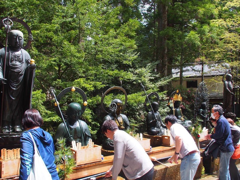
Then we visited Okunoin(https://www.japan-guide.com/e/e4901.html ), the most sacred place where Kobo Daishi is enshrined as Sokushin Jyobutsu.
We bought several famous and excellent gifts in Koyasan. One is Yakimochi, which is most delicious rice cake in Japan

https://japantravel.navitime.com/en/area/jp/spot/02301-2400346/
and Goma-dofu (cud made from sesami https://www.nankaikoya.jp/en/about/gomadofu.html )
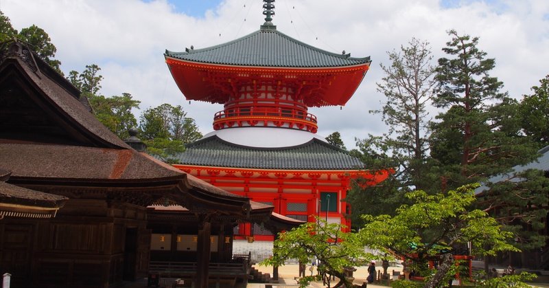
They are the best in the world. After we bought them, we went by bus to Danjyo Garan, magnificent place. The locals say they don’t go to Danjo Garan because it was build after A.D. 1200. while Koya-san was opened A.D. 800. So this is my second time to visit Danjo Garan while I have been to Okuno-in more than forty times. However, I have to say that it is amazing to see such a large and majestic temple in such a small basin. This place has grandeur like Chiang Kai-shek’s mausoleum in Taipei.

Then we walked to Daimon, large gate temple of Koyasan and walked down to Kumano Kodo, Cho-Seki-Do.
When I was a student, I was in the geography club and experienced walking around the Yamanote Line four times, walking more than 40 km. This time, if we would get stuck, there is no public transportation at all in this area. So I was more worried about whether or not there would be any accidents. The Google Maps said it would take 4 hours, but it took us 6 hours. We left at 1:00 p.m., so it became dark just as we were entering our hometown. It was just barely safe. If it were winter, I would be out.

The central part of the route is downhill, but the first 1 km which means last 1km from the base is very steep, so the last part was tough. The road is much easier to walk than the old Tokaido Highway in Hakone because there were few muddy spots, and the road is well maintained.
Cho-seki means milestome located every about 100 meters (Cho is around 100 meter) and do means road. So I took pictures of every Cho-seki whenever I found them.
When we went down, we met about 70 climbers including 10 foreigners who climbed up the road.

We went from right up side to around center. It is very difficut for foreinger to find the road because no english page will be found and even Google map does not work!!! Only Google map shows every Cho-seki without road!
I was listening to Cobalt Time(https://music.apple.com/jp/album/cobalt-time/1681019741 ) by Shitamachi_no_natsu, my favoriate Japanese Singer-Songwriter (https://www.youtube.com/watch?v=lanX2PahHis ) loudly as a bear repellent, especially after 3 hours when there was no one on the way up. There were, in fact, three people who were still going up at around 3 o’clock at a place that takes four hours to climb, and I thought it must be bad to go up to Koyasan in the dark, we cannot help them hoping they would be safe or give up climbing up at any safer place.
We reached Futatsu-Torii 二ツ鳥居 at 4:30 and went down to Nyutsuhime Shirine.

We started out in the late afternoon and were wearing light clothing, so from a risk management perspective it was not very good, but we got down to a place where cars could pass in daylight. We were lucky that we didn’t encounter any bears or boars.
Kumano Kodo
Visit Japan
World Heritage
Koyasan
この記事が気に入ったらサポートをしてみませんか?